2 Epic Hiking Days in Billings (2026 Trail-Packed Itinerary
If you’ve only got 2 days in Billings for hikers, you’re in for a surprise. This Montana city sits quietly between sandstone cliffs and the wide sweep of the Yellowstone River, giving you easy access to trails that feel wild yet close to town.
From rimrock overlooks to prairie plateaus and secret canyons, it’s a base where you can hike all day, then grab dinner downtown by sunset.
Over two trail-packed days, you’ll climb bluffs, cross open ridges, and explore places that locals hike year-round. You’ll find exact routes, a 2 days in Billings for hikers map, trail lengths, and tips on timing each stop. Every trail is within an hour’s reach, so you spend more time walking than driving.
Before you lace up, here’s what you need to know about terrain, weather, and gear. These quick insights will help you plan the best experience possible and stay safe on Montana’s rugged ground.
Hiker’s Quick Snapshot: What to Know Before You Lace Up
Billings sits around 3,100 feet above sea level. Most trails climb gently over sandstone cliffs or run flat along the Yellowstone River. Expect mixed terrain—dusty plateaus, gravel paths, and exposed bluffs with little shade.
Best seasons to hike are spring and autumn. April through June bring wildflowers and cooler days. Late September through October gives you warm light and fewer crowds. In summer, start early; the sun and wind can hit hard by noon.
Pack light but smart:
- Trail shoes with solid grip
- A 2-liter water bladder or bottles
- Hat, sunglasses, and high-SPF sunscreen
- Layered clothing (mornings are cool, afternoons dry and hot)
- Download the 2 days in Billings for hikers free map or print one before heading out
Safety matters here. Carry a paper map or GPS backup. Watch for snakes along the warm rocks. Respect private land boundaries, pack out what you bring, and follow Leave No Trace rules.
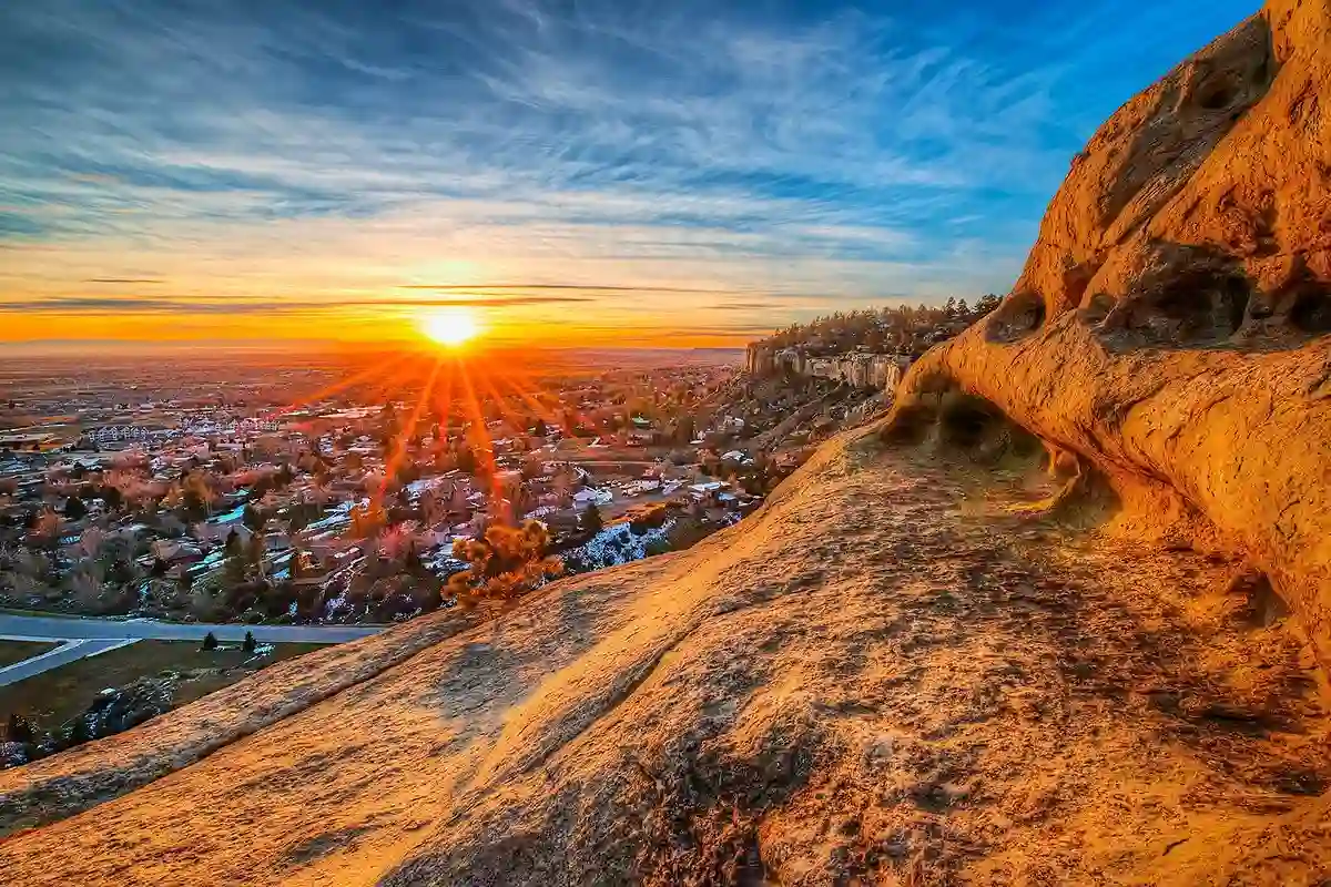
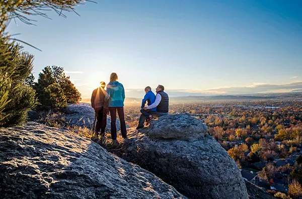
Day 1: Morning – Trail #1: Rimrocks East & Sacrifice Cliff Loop
Start your first day on the sandstone heights above the city. The Rimrocks East & Sacrifice Cliff Loop sits close to downtown Billings yet feels miles away. This trail stretches roughly 4 miles round trip, with 400 feet of elevation gain—just enough to get your legs warmed up without feeling rushed.
Arrive before 9 a.m. The light cuts across the Rimrocks beautifully then, casting long golden shadows over the cliffs and Yellowstone River below. You’ll find small parking areas near the overlook entrance. Bring layers; it can be chilly early.
The route follows the top of the bluffs before looping to Sacrifice Cliff, a place tied to local Native American history. Look for interpretive signs explaining its story. Along the edge, you’ll get panoramic views and perfect photo moments of the valley stretching west.
If you want more distance, connect to nearby spur paths for an extra mile or two. This area is ideal for sunrise photography or a quiet morning start before the day’s longer hikes. It’s one of the best hikes near Billings MT, popular among both locals and visitors.
Day 1: Afternoon – Trail #2: Four Dances Recreation Area & Plateau Walk
After a quick snack or lunch stop, head to the Four Dances Trail Billings MT area for your afternoon adventure. It’s a short drive from downtown, yet once you step onto the trail, the noise fades fast. The main path is a 3.5-mile out-and-back loop, moderate in difficulty, with wide-open sky views and sweeping cliffs above the Yellowstone River.
Expect soft wind, a bit of climb, and a whole lot of horizon. This hike is perfect for those who love open spaces rather than steep forests. You’ll likely see mule deer, hawks, and—if you’re lucky—a bald eagle circling overhead. Bring extra water; the plateau is fully exposed, and the sun can feel strong even in spring.
Plan your timing from 1:30 to 5 p.m. Start early enough to reach the main lookout before sunset. The cliff edge lights up in amber and pink tones as the city glows below. This is one of those hikes that turns quiet moments into highlights of the trip.
For an optional add-on, take a detour along the rim edge toward the southeast section for more solitude. It’s a rewarding loop if you’re chasing photos or silence away from crowds.
Evening (Day 1) – Recovery, Dinner & Night View

After wrapping up the plateau walk, head back into Billings for dinner and recovery. If you’re staying near downtown, you’ll find plenty of hiker-friendly places that serve big portions—perfect after a day outdoors. Montana Brewing Company and The Fieldhouse are local favorites for hearty meals and craft beers.
If you prefer quiet recovery, choose lodging on the Bench area. It offers easy morning access to the next day’s trails and calmer surroundings. For something short before bed, take a stroll along the upper Rimrocks again. The twilight view across the city feels peaceful, and on clear nights, the stars stretch far over the plains.
If you’re looking for unusual things to do in Billings, MT after dark, consider checking local events calendars. Outdoor concerts and night markets often pop up in summer, giving you a taste of the city beyond its trails.
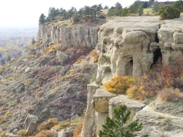
Day 2: Morning – Trail #3: Zimmerman Park to North Rimrocks Ridge
Start your second day early. Zimmerman Park sits on the north side of Billings, and the trail that runs toward the North Rimrocks Ridge makes for a perfect dawn start. The hike is about 5 miles total with rolling terrain and moderate climbs. It’s one of the quieter routes and ideal if you want views without heavy foot traffic.
Begin between 7 and 8 a.m. Bring a headlamp if you like to see the sunrise from the top—it’s worth the early alarm. As you climb, the city fades from view, replaced by soft sagebrush and wide plains that stretch forever. In spring, you’ll spot small wildflowers breaking through the dust.
This trail offers some of the best photo spots around Billings, especially where the sandstone cliffs meet open sky. You can easily extend the route if you follow the Skyline Trail Billings MT connection point. That adds a bit more mileage but rewards you with even broader vistas of the valley and surrounding rim.
When you finish, grab a coffee near the airport or in the Heights neighborhood before moving on to your next adventure. It’s a satisfying, balanced start to your second day of hiking.
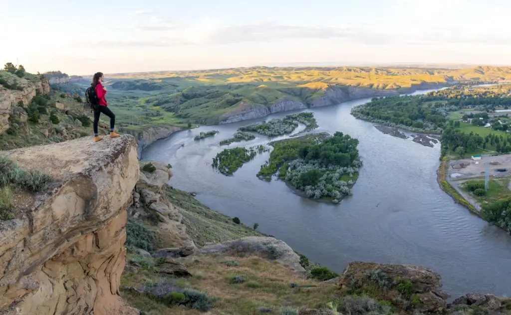
Day 2: Afternoon – Trail #4: Hidden Gem – Pryor Mountains or Elk Lake Access
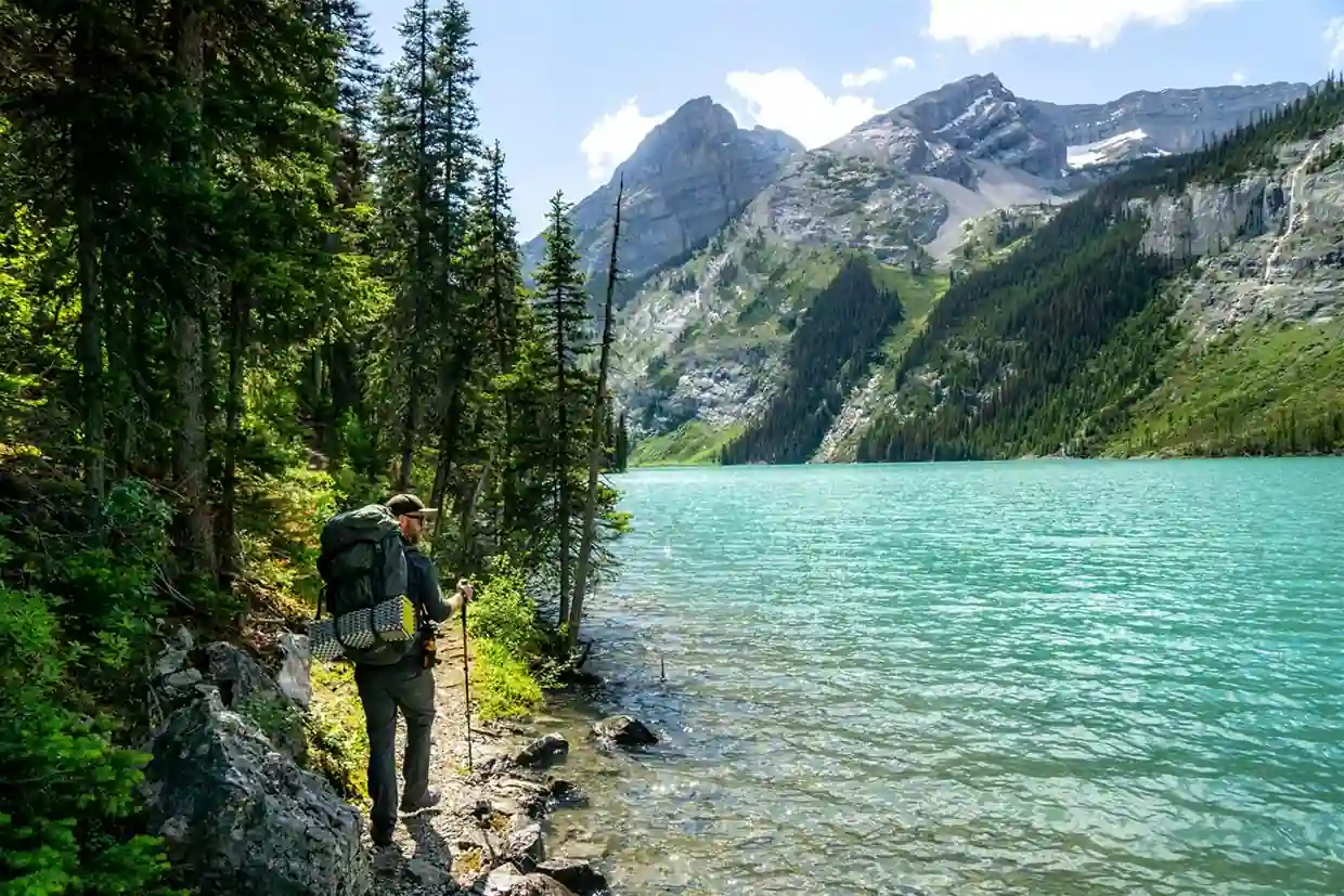
After a solid morning on the rims, it’s time to venture farther out. For your final hike, head about 45 to 60 minutes south toward the Pryor Mountains. These rugged limestone peaks hold some of Montana’s least-crowded trails and make an excellent contrast to Billings’ sandstone bluffs.
The Pryor Mountains area offers a mix of short routes and half-day hikes. Elk Lake Access is one of the most scenic, with moderate elevation gain and rewarding mountain views. You’ll pass ancient rock formations and open meadows where wild horses sometimes graze. In early summer, the area bursts with flowers and clear skies.
Plan 3 to 4 hours for this trip, including the drive. The road can be rough, so a vehicle with decent clearance helps. Bring your own lunch and plenty of water—facilities are limited out here. If you have time left in your trip, stop at the small pullouts along the way; they’re perfect for photos and quiet reflection.
If you prefer something shorter, swap this for a Waterfall hike near Billings MT like the one near Zimmerman Trail or in the Pryor foothills after rain. These smaller routes add variety without extending your driving distance too much.
Here’s a quick comparison for your planning:
| Trail Option | Distance | Drive from Billings | Effort | Highlight | Best Season |
|---|---|---|---|---|---|
| Pryor Mountains Loop | 6-8 miles | ~1 hr | Moderate | Wild horses, limestone ridges | Late Spring–Fall |
| Elk Lake Access | 5 miles | ~50 min | Moderate | Lake views, solitude | Spring–Autumn |
| Zimmerman Area Waterfall Spur | 2 miles | 10 min | Easy | Seasonal falls after rain | Spring |
Both options end your trip on a peaceful note—a quiet reward for two packed hiking days.
Evening (Day 2) – Wrap-Up, Relaxation & Reflect
You’ve earned an easy evening. After two full trail days, unwind at one of Billings’ breweries or cafés with outdoor seating. Try Last Chance Pub & Cider Mill for a local drink and wood-fired pizza. If you want a more peaceful setting, drive a few minutes out of town to enjoy the soft glow of sunset over the rim.

If your muscles are sore, consider a short soak at a nearby wellness center or hot tub hotel. It’s a good time to reflect on what stood out—the views from Sacrifice Cliff, the open wind at Four Dances, or the ridge walk above the Yellowstone River.
Before you leave, note down your favorite spots and distances for next time. Many locals repeat this loop often, finding new angles and trails each visit. Billings rewards repeat hikers with changing light, weather, and wildlife across the seasons.
Map & Driving/Trailhead Logistics
To keep things simple, here’s how your full 2 days in Billings for hikers itinerary fits together. All trailheads are close to town, connected by main roads with clear signs and easy parking.
| Trail | Drive from Downtown | Parking | Time Needed | Tip |
|---|---|---|---|---|
| Rimrocks East & Sacrifice Cliff Loop | 10 min | Free | 2 hrs | Arrive early for sunrise views |
| Four Dances Recreation Area | 15 min | Free | 3 hrs | Bring hat, no shade |
| Zimmerman Park to North Rimrocks Ridge | 12 min | Free | 3 hrs | Start at dawn for best photos |
| Pryor Mountains / Elk Lake | 45–60 min | Free | Half-day | Bring high-clearance car |
Public transport is limited, so renting a car or using rideshare apps works best. If you rely on Uber or Lyft, plan drop-offs and pick-ups at trailheads during daylight. Some areas may have spotty cell service, so confirm pickup locations ahead of time.
Download all maps offline before your trip. The 2 days in Billings for hikers reddit community often shares updated route files and condition reports—worth checking before you go.
Seasonal Planner & Alternatives
Billings offers hiking year-round, but each season changes the landscape. If you plan carefully, you can match your trails to the right time of year.
Spring (April–May)
Snowmelt feeds the rivers and brings bursts of green to the Rimrocks. Trails can get muddy, so waterproof shoes help. Fewer people visit this time, which means quieter mornings and more space on the bluffs.
Summer (June–August)
Long days, warm air, and clear skies. Start hikes early to beat the heat. The sun gets strong after 10 a.m., especially on exposed plateaus. Carry at least two liters of water per person and rest during midday.
Autumn (September–October)
This is the sweet spot. Temperatures drop, crowds thin out, and golden light paints the cliffs. It’s the best time for long ridge walks and evening hikes.
Winter (November–March)
If you don’t mind cold air, short hikes around the Rimrocks are still open. Trails can ice over, so traction cleats or microspikes are useful. Many locals keep up their hiking habit through winter—it’s peaceful, though shorter days mean earlier starts.
If weather changes suddenly or a trail closes, try Lake Elmo State Park for an easy flat loop or the nearby rim loops at Swords Park. Both keep your trip active without extra driving.
Hiker’s Checklist: Gear, Nutrition & Safety
Even short hikes in Billings need smart packing. The region’s dry air and open terrain can catch visitors off guard. Keep it simple but complete.
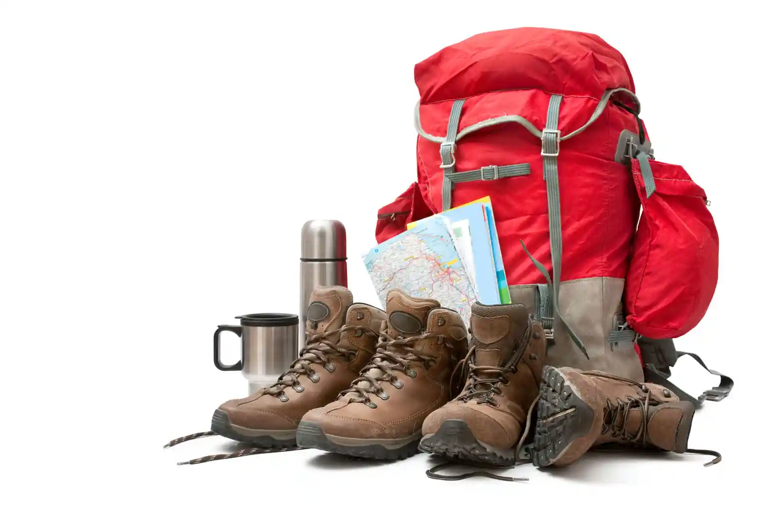
Essential Gear
- Durable trail shoes or boots with grip
- Lightweight layers for temperature swings
- Wide-brim hat, sunglasses, and sunscreen
- Daypack with hydration bladder or water bottles
- Map or GPS device (don’t rely only on cell signal)
- Small first-aid kit and extra snacks
Fuel & Hydration
Carry high-energy foods like trail mix, jerky, and granola bars. Plan water refills before heading to remote trails. The dry Montana air dehydrates faster than you think.
Safety Reminders
Let someone know your route and expected return time. Check local weather each morning. Watch for snakes in warm months and icy patches in winter. Respect wildlife and stick to marked paths.
My Final Words
Two days in Billings deliver more hiking than most travelers expect. The Rimrocks, Four Dances, and Pryor Mountains show the variety Montana packs within a short drive. You’ll finish tired but satisfied, surrounded by views that stretch endlessly over the plains.
Plan ahead, pack well, and take your time on the trails. Whether you chase sunrise on the cliffs or sunset on the plateau, these two days will remind you how close wilderness can feel—even from the edge of a small city. Now grab your boots, download the trail map, and let Billings surprise you.
Frequently Asked Questions
1. What’s the best time of year to hike around Billings?
Spring and autumn are ideal for comfortable temperatures and clear skies.
2. Are these hikes good for beginners?
Yes. Most are moderate, with optional side routes for more challenge.
3. Do I need a permit or pay a fee?
Most local trails are free to access. Only remote sites like Pryor Mountains may need seasonal checks.
4. How early should I start to avoid crowds or heat?
Arrive at trailheads by 8 a.m. in summer and midmorning in cooler months.
5. Can I bring my dog?
Dogs are allowed on many trails but must stay leashed and under control.
6. Will I have cell service?
Coverage near downtown trails is fair but spotty beyond the rim areas. Download maps ahead of time.
7. Where can I refill water?
Carry your own supply. Trailheads rarely have fountains or refill stations.
8. What if I only have one full day?
Combine Rimrocks East in the morning and Four Dances in the afternoon. It’s a complete Billings hiking day.